
Good maps, with your GIS on top.
Mapbox street maps and routing for every map in the system, with your city’s Esri ArcGIS layers drawn on top.
What it does
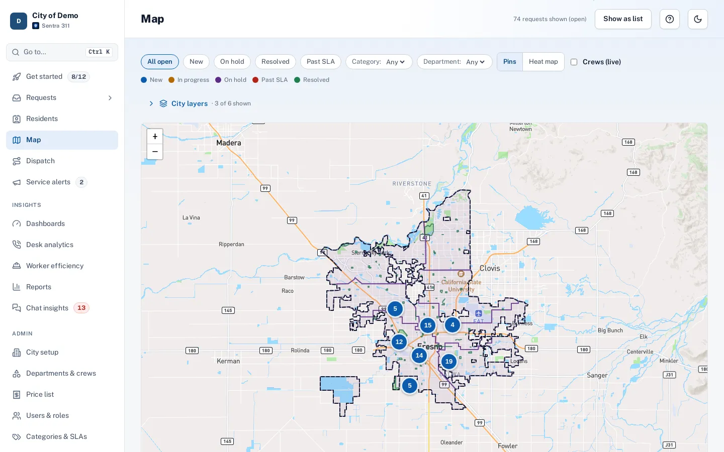
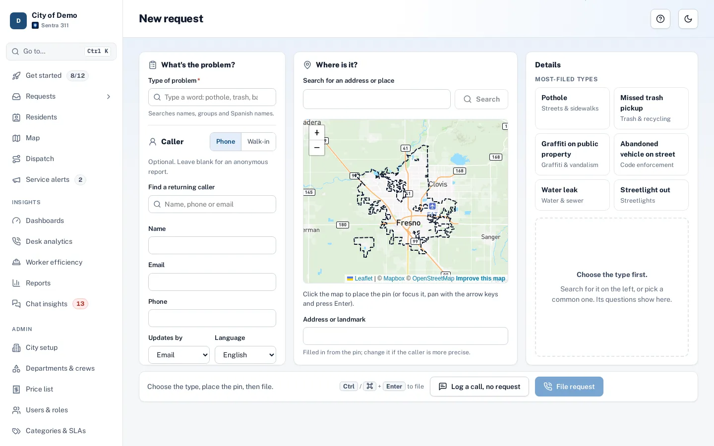
Every map in Sentra 311 — the report page, the staff map, dispatch, the worker app — uses Mapbox street maps, with a dark style when the portal is in dark mode. Dispatch and the worker app use Mapbox for drive times and routes along real streets.
On top of the street map, your city’s own Esri ArcGIS layers add council districts, service areas and aerial imagery, and your address points are used first when anyone searches for an address. If a map service is unavailable, open-source maps and routing take over so work doesn’t stop.
Free map servers aren’t built for production, and city GIS shouldn’t be re-drawn by hand.
How it works
Mapbox base maps
Light and dark styles, on the web and in the apps.
Street routing
Drive times and paths for dispatch and efficiency.
Your ArcGIS layers
Districts, routes, parks and parcels from your own services.
Key features
Mapbox maps
Light and dark styles, high-resolution only on screens that need it.
Drive-time routing
Ordering stops and street paths for dispatch.
Esri ArcGIS layers
Lookup and display layers from your services.
City address points first
Official addresses and parcel numbers before general geocoding.
Fallbacks
OpenStreetMap and open-source routing if a service is down.
A day with it
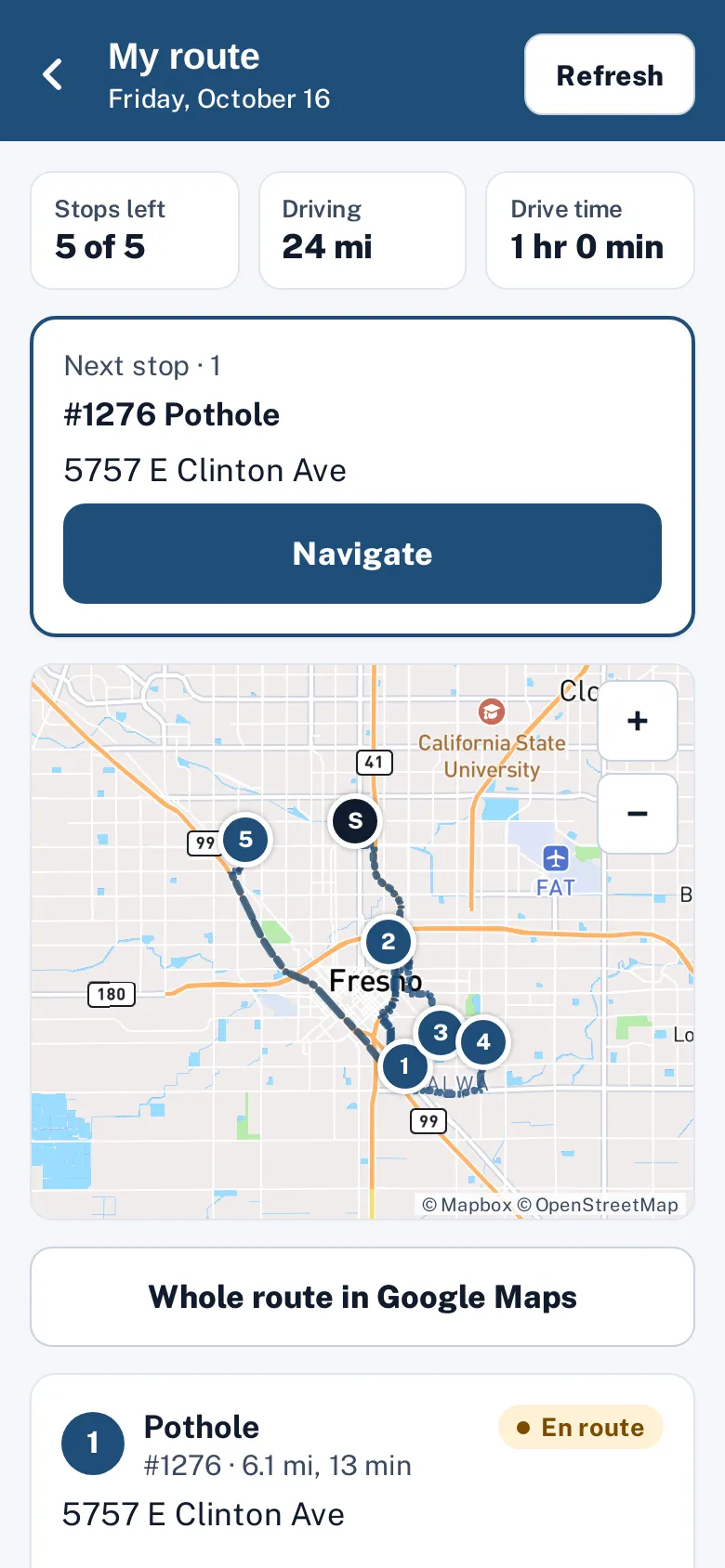
The resident report page and app (placing the pin), tracking pages, the staff queue’s map view and the full-screen map, the request page, dispatch and route sheets, worker efficiency maps, the worker app (jobs, nearby and my route) and the public performance page all use the same map service.
- Staff maps switch to a dark style in dark mode.
- Routing powers dispatch (drive-time ordering, street paths, miles and minutes per leg), the worker app’s route, live crew ETAs and worker efficiency day routes.
- Distances are shown in miles and feet.
In practice
- Accurate addresses. Address search finds the city’s official address and parcel first.
- Night shift. Staff maps switch to the dark style in dark mode.
- Routing in miles. Route sheets show miles and drive minutes per leg.
Addresses
Address search and map-click lookups use your city’s address points layer first (with parcel numbers when available), then general geocoding for landmarks and intersections. Results are cached to keep lookups fast.
Miles, feet and accuracy
Distances are shown the way US crews and residents read them: miles for routes and nearby jobs, feet for short distances. Route totals and each leg show miles and drive minutes, and estimates are labeled when exact routing isn’t available.
Accessibility, security and privacy
Map and routing usage is included in your price and shown on the usage page.
Who uses it
Dispatchers
Accurate routes.
GIS staff
Their data, used everywhere.
Questions cities ask
Do we need our own Mapbox account?
No. Maps and routing are included.
What if Mapbox is unavailable?
Maps fall back to OpenStreetMap tiles and routing to an open-source router, so work continues.
Can we use our own basemap?
Street maps come from Mapbox; your ArcGIS layers, including imagery, can be shown on top.