
See the city the way your GIS team does.
Every request on a map with clusters and heat, plus your city’s own ArcGIS layers: council districts, trash routes, parks, parcels.
What it does
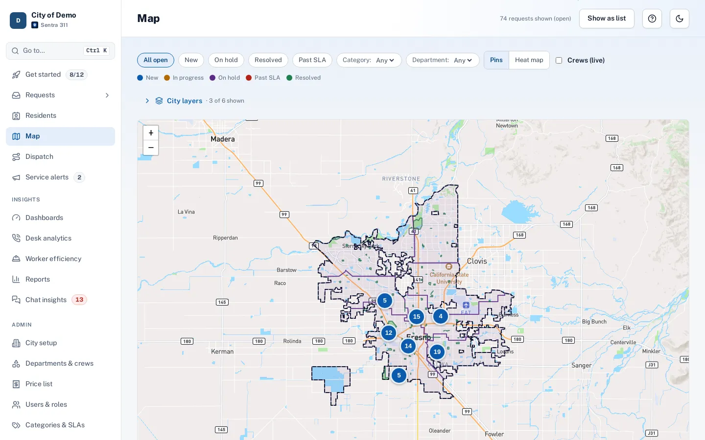
The staff map shows every request matching the current filters, with pins colored by status and clusters that open as you zoom. Toggle your city’s own ArcGIS layers — council districts, parks, trash pickup days, street sweeping routes, aerial imagery — on top of street maps from Mapbox.
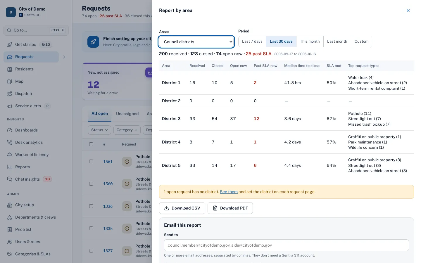
Layers marked as lookups are checked for every new request: the request records which council district it’s in, which day trash is picked up there, or which sweeping route covers it, and staff see those values on the request page. Reports can group by any lookup layer.
Requests without geography can’t answer "where are we falling behind?"
How it works
Connect your GIS
Browse your ArcGIS services and pick layers. No exports.
Look up on every request
District, trash day, parcel number and more are stored with the request.
Filter and report by area
Any lookup layer becomes a grouping in reports.
Key features
Status pins and clusters
Thousands of requests stay readable; clusters show counts and zoom in on click.
Your ArcGIS layers
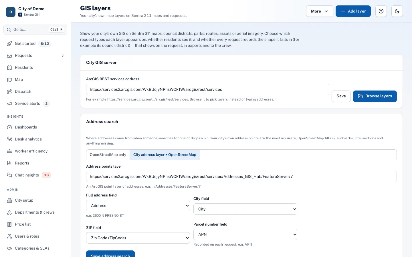
Browse your ArcGIS services in Admin › GIS layers and add layers in a few clicks.
Lookups on every request
Council district, trash day, sweeping route — stored on the request and shown in an “All fields” view.
Group reports by layer
Any lookup layer can be a grouping in reports.
Address layer first
Address search uses your city’s official address points before general geocoding.
Dark map style
The map follows the portal’s dark mode.
A day with it
Admin › GIS layers includes a browser for ArcGIS services: paste your city’s ArcGIS server or Hub address, browse its layers, preview them on the map and add them.
- A display layer appears as a toggle on staff maps (and optionally on the public report map).
- A lookup layer is also checked for every new request, and the value — “District 5”, “Thursday”, “Route 4” — is stored on the request and shown on the request page, with an “All fields” dialog listing every attribute the GIS has for that spot.
- Council districts can be imported from a GIS layer into Sentra 311’s district boundaries, which drive routing and district reports.
- Your address points layer, with parcel numbers, is used first for address search and for the address filled in from a map click.
In practice
- Trash day on every request. Each new request records the pickup day from the city’s GIS layer.
- Clusters of complaints. The map shows a cluster of streetlight reports on one corridor.
- Parks layer. Park boundaries on the staff map help dispatchers send park requests to the Parks crew.
A map that stays fast
With thousands of requests in view, the map asks the server only for what’s on screen and shows clusters with counts when there are too many pins, so even a city with 100,000 historical requests loads quickly. Clicking a cluster zooms in.
Accessibility, security and privacy
Your GIS layers are read from your own ArcGIS services; Sentra 311 stores only the lookup values on each request.
Getting started
Your GIS staff or ours connect the layers during setup. See districts & parcels for council district boundaries and parcel numbers.
Who uses it
Dispatchers
Spot clusters and plan routes.
GIS staff
Connect existing layers without rebuilding them.
Council offices
Requests counted in their districts automatically.
Questions cities ask
Do we need Esri?
No, but if your city has ArcGIS services, Sentra 311 uses them directly.
Do we need Esri?
No. Street maps come from Mapbox; ArcGIS layers are optional and use the city’s existing services.
How many layers can we add?
As many as you find useful; most cities start with council districts and one or two service layers.
Can residents see our GIS layers?
Only layers you mark as public, such as city limits or council districts on the report map.
Do GIS lookups slow down filing?
No. Lookups run in the background after the request is filed.
Can we see aerial imagery?
Yes, if your city publishes an imagery layer, as a toggle on staff maps.