
Every request knows its district and parcel.
Requests are placed in a council district automatically, and parcel numbers (APNs) come from your address layer. Staff can set a missing district by hand.
What it does
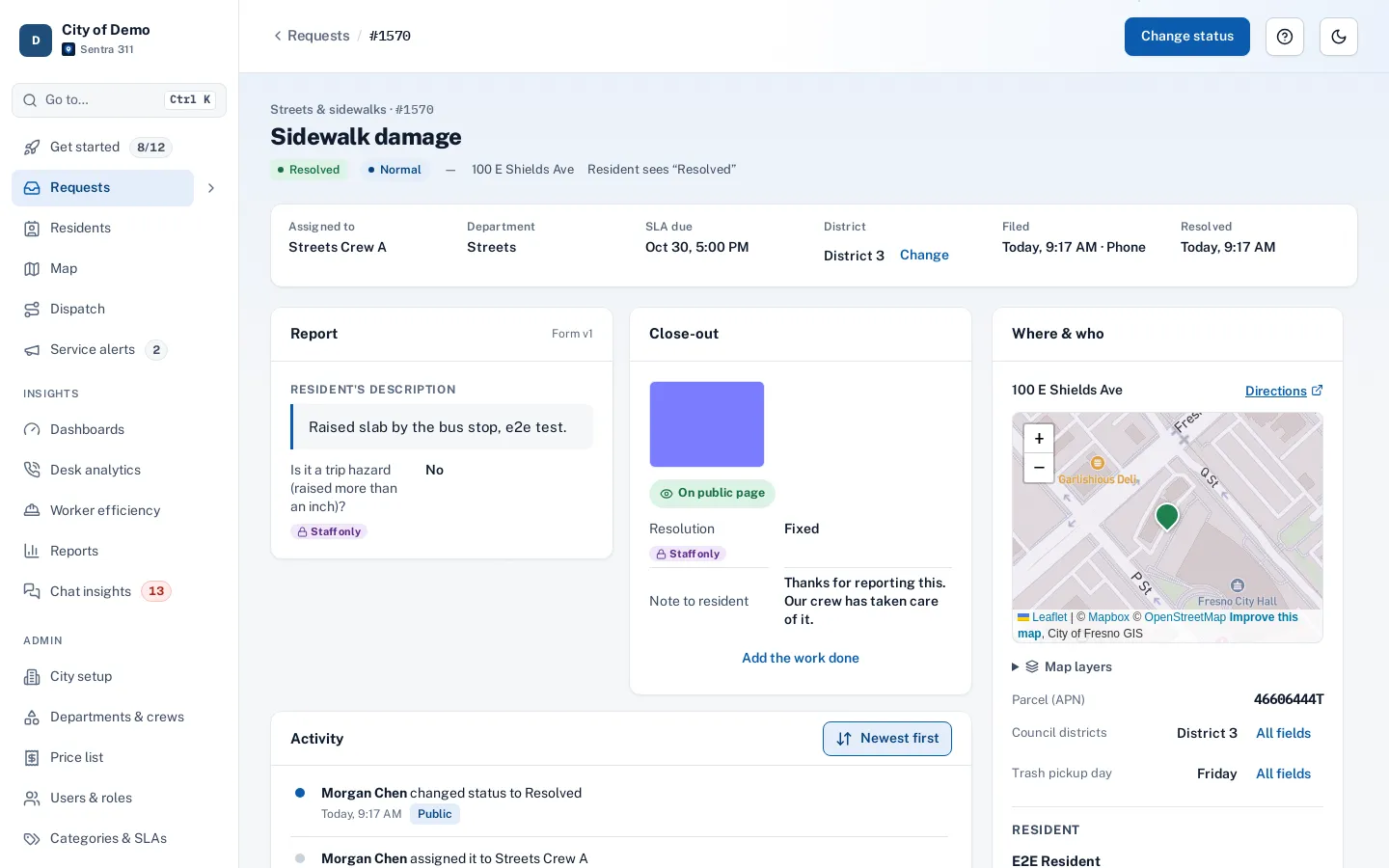
Sentra 311 places each request in its council district the moment the pin is dropped, using district boundaries imported from your GIS or drawn in the admin portal. Routing can use the district, reports group by it, and the request page shows it with a Change button for the occasional request that needs a correction.
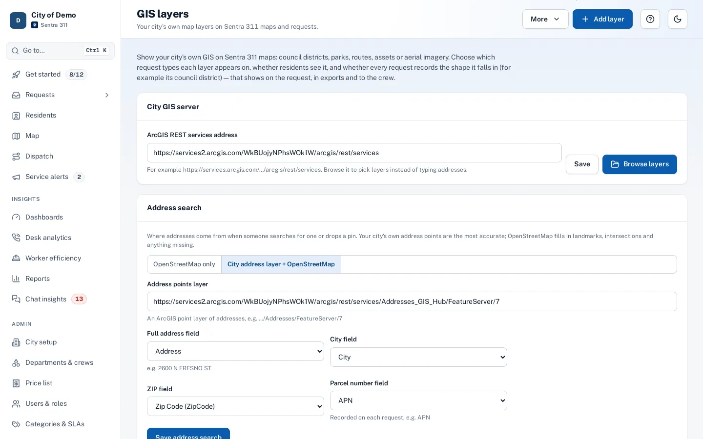
When your city’s address layer includes parcel numbers, Sentra 311 records the APN on the request, and staff can search the queue by parcel number — useful for code enforcement and properties with repeated complaints.
Council members ask "what’s happening in my district?" and someone builds a spreadsheet.
How it works
Place automatically
From the pin and your district boundaries.
Fix the misses
A "No district" filter and a setter on the request page.
Report and email by district
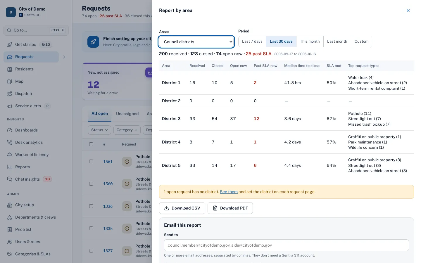
Received, closed, open, past SLA and top types per district.
Key features
Automatic district placement
From the pin, using your district boundaries.
Set or change by hand
A district setter on the request page, with a “No district” queue filter.
Parcel numbers (APN)
Recorded from the address layer and searchable.
District-based routing
Route a type to different departments or crews by district.
District reports
Every district listed, even with zero requests.
A day with it
District boundaries can be imported from a GIS layer (for example, the city’s council district layer on ArcGIS) or drawn and edited in Admin › Districts.
- Each new request is placed in the district that contains its pin.
- If a request has no pin, or its pin falls outside every district — a park, a county island, a corner the boundaries miss — it has no district until staff set one.
- The queue’s District filter includes “No district (needs one)”, and the area report shows a “No district” row with a link to those requests.
- On the request page, the District field has “Set district…” or “Change”, and the change is recorded in the timeline.
In practice
- A council question. District 2’s office asks how many requests came from their district; the report answers in seconds.
- Repeat complaints at one property. Code enforcement searches by parcel number and sees every request at that address.
- A pin in a county island. The request shows in “No district” and staff set the right district by hand.
Parcel numbers
When the city’s address layer includes parcel numbers (APN), Sentra 311 records the parcel on each request whose address matches. Staff can search the queue by APN to see every request for a property — useful for code enforcement, repeated complaints and coordination with building and planning.
Districts in reports and on public pages
Every report can group by district, and the area report lists each district with received, closed, open and past-SLA counts, time to close and top request types. Dashboards can be filtered by department, and the public performance page can show results by council district when the city turns that section on.
Getting started
Import district boundaries from a GIS layer or draw them during setup.
Who uses it
Council offices
Accurate counts for their districts.
Code enforcement
Search by parcel number.
Dispatchers
District-based routing to the right crew.
Questions cities ask
What if a pin is outside every district?
It shows as "No district" and staff can set it on the request page.
What if our districts change after redistricting?
Import the new boundaries; new requests use them right away.
Can residents see districts?
The public performance page can show results by district if the city turns that on.
Does routing use districts?
Yes, when district routing is turned on: a type can go to different departments or crews by district.
Can we have more than one kind of district?
Council districts are built in; other areas such as service zones work through GIS lookup layers.